Community Garden Directory
Find a Community Garden in Your Neighborhood
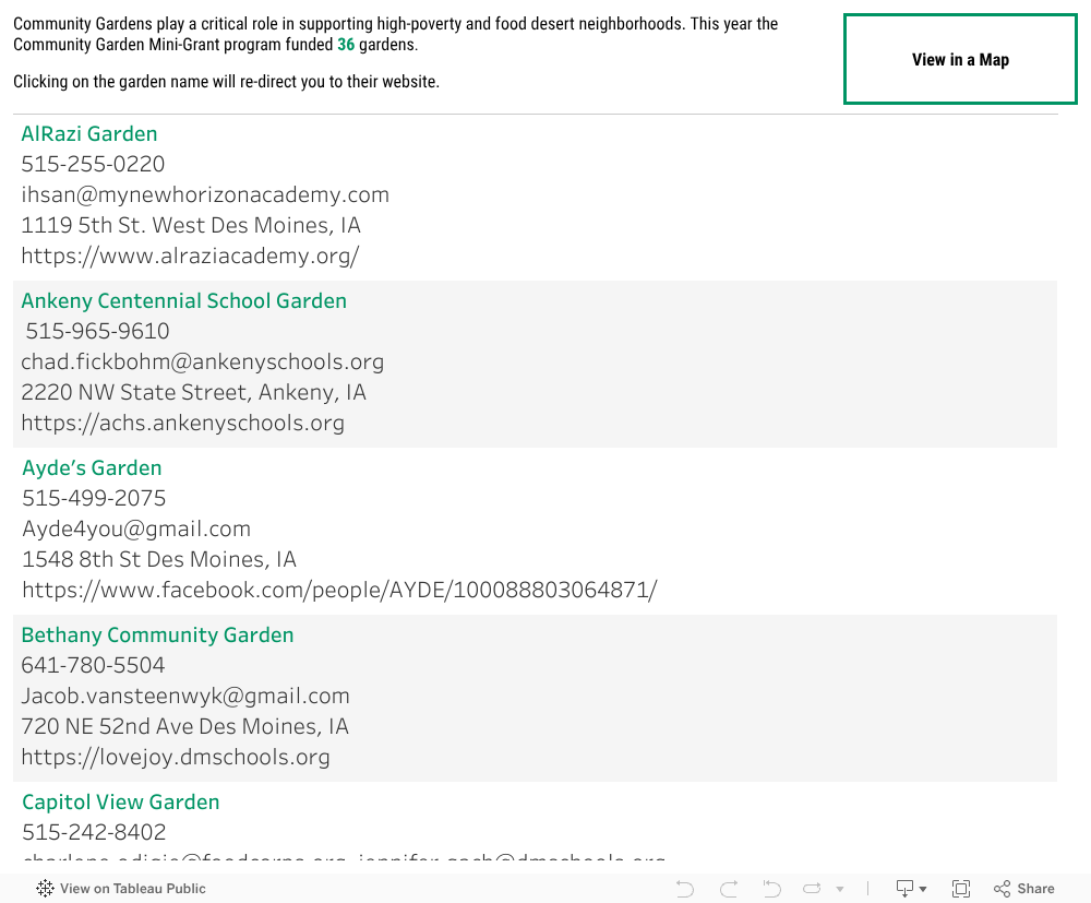
Here you can find the Community Gardens sponsored by United Way of Central Iowa throughout our community.
Make a Difference
Sign up and take action
Sign up to receive news from United Way of Central Iowa including advocacy updates, volunteer opportunities, special events, and more.